- Europe
- United Kingdom
- Orkney Islands
- Wass Wick
-
 Search
Traveling Luck for Wass Wick Orkney Islands, United Kingdom 
The timezone in Wass Wick is Europe/London
Morning Sunrise at 09:04 and Evening Sunset at 15:13. It's Dark
Rough GPS position Latitude. 59.0833°, Longitude. -3.0167°
Morning Sunrise at 09:04 and Evening Sunset at 15:13. It's Dark
Rough GPS position Latitude. 59.0833°, Longitude. -3.0167°
Weather near Wass Wick Last report from Kirkwall Airport, 16.4km away
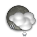
 shower(s) rain small hail/snow pellets Temperature: 4°C / 39°F
Wind: 23km/h West gusting to 36.8km/h
Cloud: Few Cumulonimbus at 1400ft Scattered at 2200ft Broken at 3300ft
Satellite map of Wass Wick and it's surroudings...
Geographic features & Photographs around Wass Wick in Orkney Islands, United Kingdom
point a tapering piece of land projecting into a body of water, less prominent than a cape.
- Banks (1km)
- Odin Ness (2km)
- Scara Taing (2.9km)
- Ness of Boray (3.7km)
- Point of Vastray (4.5km)
- Stromness Taing (5km)
- Point of Hellia (5.7km)
- Taing of Trumland (6km)
- Mou Ness (6.3km)
- Point of Avelshay (6.7km)
- Point of Skeo (6.7km)
- The Galt (7.2km)
- Point of the Wart (7.2km)
- Vasa Point (7.3km)
- Twinness (7.9km)
- Ferry Point (8km)
- Ramberry (8km)
- Point of Backaquoy (8.5km)
- Point of Hisber (9.3km)
bay a coastal indentation between two capes or headlands, larger than a cove but smaller than a gulf.
- Wass Wick (0km)
- Wood Wick (2.9km)
- Millburn Bay (4.1km)
- Bay of Isbister (4.1km)
- Wide Firth (6.3km)
- Rack Wick (6.3km)
- Bay of Furrowend (7.3km)
- Bay of Firth (8.5km)
- Elwick (9.3km)
island a tract of land, smaller than a continent, surrounded by water at high water.
- Gairsay (3.1km)
- Sweyn Holm (4.1km)
- Holm of Boray (4.5km)
- Wyre (5km)
- Grass Holm (5.5km)
- Shapinsay (9.1km)
cape a land area, more prominent than a point, projecting into the sea and marking a notable change in coastal direction.
- Crookness (4km)
- Tor Ness (4.1km)
- Aiker Ness (5.7km)
- Salt Ness (6.4km)
- Strombery (7.9km)
Accommodation around Wass Wick
The Albert Hotel The Albert Hotel Mounthoolie Lane, Kirkwall
Albert Hotel Mounthoolie Lane, Kirkwall
Broad Street Gardens Apartments Townhouse BROAD STREET GARDENS JUNCTION ROAD, KIRKWALL
rock a conspicuous, isolated rocky mass.
- Seal Skerry (2.9km)
- Puldrite Skerry (4.5km)
- Linga Skerry (6.7km)
- Quoy (7.2km)
- Quanterness Skerry (7.9km)
sound a long arm of the sea forming a channel between the mainland and an island or islands; or connecting two larger bodies of water.
- Gairsay Sound (2.9km)
- Wyre Sound (4.1km)
- Eynhallow Sound (7.8km)
- Rousay Sound (8.9km)
peninsula an elongate area of land projecting into a body of water and nearly surrounded by water.
- North Head (3.1km)
- Hen of Gairsay (4.1km)
- The Taing (4.1km)
populated place a city, town, village, or other agglomeration of buildings where people live and work.
shoal(s) a surface-navigation hazard composed of unconsolidated material.
- Broad Shoal (5.5km)
- Scargun Shoal (8.2km)
rocks conspicuous, isolated rocky masses.
- Skertours (5.5km)
- West Skerries (6.7km)
channel the deepest part of a stream, bay, lagoon, or strait, through which the main current flows.
- Burgar Röst (9.3km)
reef(s) a surface-navigation hazard composed of consolidated material.
- Point of the Graand (8.5km)
bank(s) an elevation, typically located on a shelf, over which the depth of water is relatively shallow but sufficient for most surface navigation.
- Sands of Evie (6.5km)
 Wikipedia entries close to Wass Wick
- Gairsay isle isle
- Wyre isle isle
- Orkney isle isle
- Rousay isle isle
- Egilsay isle isle
- Eynhallow isle isle
- Shapinsay isle isle
- Finstown city o city
- Kirkwall city k city
- Mainland (Orkney) isle isle
- Kirkwall Airport airport airport
- Eday Airport airport airport
- Eday isle isle
- Faray isle isle
- Skara Brae world herita landmark
- Brough of Birsay tower
Airports close to Wass Wick
Kirkwall(KOI), Kirkwall, Scotland (16.4km)Wick(WIC), Wick, U.k. (74.7km)
Sumburgh(LSI), Sumburgh, U.k. (140.7km)
Lossiemouth(LMO), Lossiemouth, U.k (166.1km)
Scatsta(SDZ), Scatsta, U.k. (190.5km)
 Explore around
Wass Wick?
 Wikipedia near Wass Wick
 Where to stay near Wass Wick

