Traveling Luck for Lechner-Alpe Bayern, Germany 
The timezone in Lechner-Alpe is Europe/Berlin
Morning Sunrise at 07:56 and Evening Sunset at 16:21. It's Dark
Rough GPS position Latitude. 47.7167°, Longitude. 12.0500°
Morning Sunrise at 07:56 and Evening Sunset at 16:21. It's Dark
Rough GPS position Latitude. 47.7167°, Longitude. 12.0500°
Weather near Lechner-Alpe Last report from Erding, 77.2km away
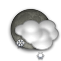
 shower(s) snow small hail/snow pellets Temperature: 1°C / 34°F
Wind: 15km/h West gusting to 26.5km/h
Cloud: Few at 600ft Broken at 2300ft
Satellite map of Lechner-Alpe and it's surroudings...
Geographic features & Photographs around Lechner-Alpe in Bayern, Germany
hut a small primitive house.
- Lechner-Alpe (0km)
- Schloß-Alpe (1.4km)
- Mitter-Alpe (1.4km)
- Schuhbräu-Alpe (2.1km)
- Schlipfgrub-Alpe (2.1km)
- Rampold-Alpe (2.1km)
- Wild-Alpe (2.1km)
- Jackelberger-Alpe (2.1km)
- Hillsteiner-Alpe (2.6km)
- Antretter-Alpe (2.6km)
- Hansen-Alpe (2.6km)
- Kronberger-Alpe (2.6km)
- Arzmoos-Alpe (2.6km)
- Lacher-Alpe (2.6km)
- Soin-Alpe (2.6km)
- Reindler-Alpe (2.9km)
- Maier-Alpe (3.6km)
- Gundelsberger-Alpe (3.6km)
- Wirts-Alpe (3.6km)
- Staucher-Alpe (3.6km)
- Siegel-Alpe (3.6km)
- Wendelsteiner-Alpen (3.6km)
- Kreuter-Alpe (3.6km)
- Schweinsteiger-Alpe (4.2km)
- Rieder-Alpe (4.2km)
- Bergfeld (4.3km)
- Antritt-Alpe (4.3km)
- Elbach-Alpe (4.3km)
- Huber-Alpe (4.5km)
- Hansen-Alpe (4.5km)
mountain an elevation standing high above the surrounding area with small summit area, steep slopes and local relief of 300m or more.
- Rampoldplatte (0km)
- Zugberg (1.4km)
- Stapfen (2.1km)
- Mitterberg (2.1km)
- Breitenberg (2.6km)
- Schrofen (2.6km)
- Schortenkopf (2.6km)
- Dümpfel (2.6km)
- Mutterberg (2.6km)
- Wildalpjoch (2.6km)
- Tagweidkopf (2.6km)
- Wendelstein (3.6km)
- Bockstein (3.6km)
- Riesenberg (4.3km)
- Hoheleite (4.5km)
- Farrenpoint (4.5km)
farm a tract of land with associated buildings devoted to agriculture.
- Bichl (3.6km)
- Lechen (3.6km)
- Höllenstein (3.6km)
- Ulpoint (4.2km)
populated place a city, town, village, or other agglomeration of buildings where people live and work.
- Aich (3.6km)
- Kirchbach (3.6km)
- Sankt Margarethen (3.6km)
- Erlach (4.3km)
Accommodation around Lechner-Alpe
Ayurveda Resort Sonnhof Hinterthiersee, Thiersee
Hotel Garni KĂśnigslinde Schlierseer StraĂe 2, Bayrischzell
BEST WESTERN Grand City Rosenheim Brixstrasse 3, Rosenheim
cliff(s) a high, steep to perpendicular slope overlooking a waterbody or lower area.
- Hochsalwand (1.4km)
- Haidwand (2.9km)
stream a body of running water moving to a lower level in a channel on land.
- Förchenbach (2.9km)
- Mühlbach (2.9km)
slope(s) a surface with a relatively uniform slope angle.
- Soinwand (3.6km)
peak a pointed elevation atop a mountain, ridge, or other hypsographic feature.
- Lacherspitz (3.6km)
railroad station a facility comprising ticket office, platforms, etc. for loading and unloading train passengers and freight.
- Bahnhof Wendelstein (3.5km)
 Wikipedia entries close to Lechner-Alpe
- Hochsalwand mountain h mountain
- Wendelstein (Berg) mountain h mountain
- Brannenburg city k city
- Breitenstein (Berg) mountain h mountain
- Hohe Asten building landmark
- Maiwand (Berg) mountain h mountain
- Petersberg (Flintsbach) mountain i mountain
- Bayrischzell city m city
- Flintsbach am Inn city l city
- Birkenstein city o city
- Fischbachau city k city
- Großer Traithen mountain h mountain
- Wildbarren mountain h mountain
- Nußdorf am Inn city l city
- Bad Feilnbach city k city
- Elbach (Fischbachau) city o city
Airports close to Lechner-Alpe
Oberpfaffenhofen(OBF), Oberpfaffenhofen, Germany (80.1km)Salzburg(SZG), Salzburg, Austria (82.3km)
Munich(MUC), Munich, Germany (83.8km)
Innsbruck(INN), Innsbruck, Austria (84.1km)
Furstenfeldbruck(FEL), Fuerstenfeldbruck, Germany (91.1km)
Airfields or small strips close to Lechner-Alpe
Erding, Erding, Germany (77.2km)Eggenfelden, Eggenfelden, Germany (103.4km)
Landsberg lech, Landsberg, Germany (107.5km)
Lechfeld, Lechfeld, Germany (117.4km)
Ingolstadt manching, Ingolstadt, Germany (133.8km)

 Search
 Explore around
Lechner-Alpe?
 Wikipedia near Lechner-Alpe
 Where to stay near Lechner-Alpe

