Traveling Luck for Leim-Bach Bayern, Germany 
The timezone in Leim-Bach is Europe/Berlin
Morning Sunrise at 07:58 and Evening Sunset at 16:20. It's Dark
Rough GPS position Latitude. 48.0333°, Longitude. 12.2000°
Morning Sunrise at 07:58 and Evening Sunset at 16:20. It's Dark
Rough GPS position Latitude. 48.0333°, Longitude. 12.2000°
Weather near Leim-Bach Last report from Erding, 42.3km away
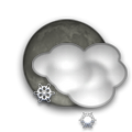
 shower(s) snow small hail/snow pellets Temperature: 1°C / 34°F
Wind: 15km/h West gusting to 26.5km/h
Cloud: Few at 600ft Broken at 2300ft
Satellite map of Leim-Bach and it's surroudings...
Geographic features & Photographs around Leim-Bach in Bayern, Germany
populated place a city, town, village, or other agglomeration of buildings where people live and work.
- Freiham (0km)
- Hausmehring (0km)
- Limburg (1.4km)
- Kornberg (1.4km)
- Spielberg (1.4km)
- Höhfelden (1.4km)
- Reitmehring (2.1km)
- Kerschdorf (2.1km)
- Laiming (2.1km)
- Viehhausen (2.5km)
- Reisach (2.5km)
- Attel (2.5km)
- Hafenham (2.8km)
- Roßhart (2.8km)
- Allmannsberg (2.8km)
- Breitbrunn (3.5km)
- Bachmehring (3.5km)
- Eiselfing (3.5km)
- Weikertsham (3.5km)
- Thalham (3.5km)
- Aham (3.5km)
- Attelthal (3.5km)
- Sendling (3.5km)
- Koblberg (4.2km)
- Kettenham (4.2km)
- Bergham (4.2km)
- Raming (4.2km)
- Straß (4.2km)
- Alteiselfing (4.3km)
- Hart (4.3km)
- Seewies (4.5km)
- Griesstätt (4.5km)
- Langwied (4.7km)
- Bergham (4.7km)
- Ramerberg (4.7km)
- Wasserburg am Inn (5.1km)
- Neudeck (5.1km)
- Odelsham (5.1km)
- Rudering (5.1km)
- Edling (5.1km)
- Katzbach (5.1km)
- Graben (5.7km)
farm a tract of land with associated buildings devoted to agriculture.
- Herder (2.5km)
- Altenhohenau (4.5km)
- Eßbaum (4.5km)
- Weitmoos (4.5km)
- Moosham (4.5km)
- Perfall (4.7km)
- Unterkatzbach (5.1km)
- Rettenbach (5.1km)
forest(s) an area dominated by tree vegetation.
- Bach-Holz (2.5km)
- Laiminger-Holz (4.2km)
- Oster Holz (4.5km)
- Altenhohenau (4.5km)
stream a body of running water moving to a lower level in a channel on land.
Accommodation around Leim-Bach
Hotel Seeblick Pelham 4, Bad Endorf
Hotel Gasthof Oberwirt Kienbergerstrasse 14, Obing
Hotel HÜlzerbräu Sieghartstr. 1, Ebersberg
grazing area an area of grasses and shrubs used for grazing.
- Ahamer Filz (4.5km)
- Schwarzes Moos (5.7km)
railroad station a facility comprising ticket office, platforms, etc. for loading and unloading train passengers and freight.
- Bahnhof Wasserburg (4.3km)
 Wikipedia entries close to Leim-Bach
- Elend (Wasserburg) city o city
- Eiselfing city l city
- Griesstätt city l city
- Wasserburg am Inn city i city
- Ramerberg city m city
- Edling city l city
- Pfaffing (Landkreis Rosenheim) city l city
- Halfing city l city
- Schonstett city m city
- Babensham city l city
- Soyen city l city
- Vogtareuth city l city
- Amerang city l city
- Rechtmehring city m city
- Rott am Inn city l city
- Albaching city m city
Airports close to Leim-Bach
Munich(MUC), Munich, Germany (53.6km)Salzburg(SZG), Salzburg, Austria (75km)
Oberpfaffenhofen(OBF), Oberpfaffenhofen, Germany (78.1km)
Furstenfeldbruck(FEL), Fuerstenfeldbruck, Germany (82.1km)
Augsburg(AGB), Augsburg, Germany (118.2km)
Airfields or small strips close to Leim-Bach
Erding, Erding, Germany (42.3km)Eggenfelden, Eggenfelden, Germany (63.8km)
Ingolstadt manching, Ingolstadt, Germany (102.9km)
Landsberg lech, Landsberg, Germany (110.1km)
Straubing, Straubing, Germany (112.9km)

 Search
 Explore around
Leim-Bach?
 Wikipedia near Leim-Bach
 Where to stay near Leim-Bach

