Traveling Luck for Ober-Lehen Bayern, Germany 
The timezone in Ober-Lehen is Europe/Berlin
Morning Sunrise at 06:23 and Evening Sunset at 18:13. It's Dark
Rough GPS position Latitude. 48.4333°, Longitude. 12.7833°
Morning Sunrise at 06:23 and Evening Sunset at 18:13. It's Dark
Rough GPS position Latitude. 48.4333°, Longitude. 12.7833°
Weather near Ober-Lehen Last report from Erding, 71.7km away
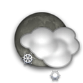
 shower(s) snow small hail/snow pellets Temperature: 1°C / 34°F
Wind: 15km/h West gusting to 26.5km/h
Cloud: Few at 600ft Broken at 2300ft
Satellite map of Ober-Lehen and it's surroudings...
Geographic features & Photographs around Ober-Lehen in Bayern, Germany
farm a tract of land with associated buildings devoted to agriculture.
- Unter-Lehen (0km)
- Ober-Lehen (0km)
- Königsöd (0km)
- Höll (1.4km)
- Hänghub (1.4km)
- Maissling (1.4km)
- Untereisbeck (1.4km)
- Griffl (1.4km)
- Guglmucken (2.1km)
- Feitshof (2.5km)
- Starzen (2.5km)
- Ponzaun (2.5km)
- Lichtenberg (2.5km)
- Simonsöd (2.5km)
- Stumsöd (2.5km)
- Kastenberg (2.5km)
- Rackersbach (2.5km)
- Kollbeck (2.8km)
- Ferlin (2.8km)
- Kranzlhub (2.8km)
- Obereschlbach (3.5km)
- Wölfing (3.5km)
- Glatzöd (3.5km)
- Wolfsberg (3.5km)
- Holzapfel (4.2km)
- Kochlehen (4.2km)
- Lacken (4.2km)
- Reiter (4.2km)
- Hochwimm (4.2km)
- Hausmanning (4.4km)
- Roith (4.4km)
- Demmelhub (4.4km)
- Grub (4.4km)
populated place a city, town, village, or other agglomeration of buildings where people live and work.
- Mehring (1.4km)
- Prienbach (1.4km)
- Remmelsberg (2.1km)
- Windorf (2.1km)
- Zellhub (2.1km)
- Hausleiten (2.5km)
- Perterting (2.5km)
- Obereisbeck (2.5km)
- Spanberg (2.5km)
- Weidelsberg (2.5km)
- Peterskirchen (2.8km)
- Kainzl (2.8km)
- Wenigau (3.5km)
- Edhof (3.5km)
- Untereisbach (4.2km)
- Kirchberg (4.2km)
- Latzelsberg (4.2km)
- Thal (4.2km)
- Gern (4.2km)
- Kasten (4.4km)
- Eggenfelden (4.4km)
- Sankt Sebastian (4.4km)
- Bruckhäuser (4.4km)
- Tiefstadt (4.4km)
stream a body of running water moving to a lower level in a channel on land.
- Geratskirchner Bach (4.2km)
- Mertsee Bach (4.4km)
administrative division an administrative division of a country, undifferentiated as to administrative level.
- Gern Zwei (4.4km)
Accommodation around Ober-Lehen
Vitalhotel Bad Birnbach Brunnaderstrasse 27, Bad Birnbach
Hotel Sternsteinhof Brunnaderstr. 8 -10, Bad Birnbach
Hotel Chrysantihof Brunnaderstr. 7, Bad Birnbach
locality a minor area or place of unspecified or mixed character and indefinite boundaries.
- Drittenbrei (3.5km)
 Wikipedia entries close to Ober-Lehen
- Eggenfelden city i city
- Mertsee reservoir waterbody
- Massing city l city
- Malgersdorf city m city
- Hebertsfelden city l city
- Heiligenberg bei Schönau city n city
- Lohbruck city o city
- Flugplatz Eggenfelden airport airport
- Falkenberg (Niederbayern) city l city
- Schönau (Niederbayern) city m city
- Diepoltskirchen city o city
- Postmünster city m city
- Wurmannsquick city l city
- Mitterskirchen city m city
- Pfarrkirchen city i city
- Rimbach (Niederbayern) city n city
Airports close to Ober-Lehen
Salzburg(SZG), Salzburg, Austria (83.3km)Munich(MUC), Munich, Germany (84.6km)
Horsching international airport (aus - afb)(LNZ), Linz, Austria (120.8km)
Furstenfeldbruck(FEL), Fuerstenfeldbruck, Germany (131.2km)
Oberpfaffenhofen(OBF), Oberpfaffenhofen, Germany (134.4km)
Airfields or small strips close to Ober-Lehen
Eggenfelden, Eggenfelden, Germany (6.9km)Vilshofen, Vilshofen, Germany (43km)
Straubing, Straubing, Germany (63km)
Erding, Erding, Germany (71.7km)
Ingolstadt manching, Ingolstadt, Germany (110.6km)

 Search
 Explore around
Ober-Lehen?
 Wikipedia near Ober-Lehen
 Where to stay near Ober-Lehen

