Traveling Luck for Rins-See Bayern, Germany 
The timezone in Rins-See is Europe/Berlin
Morning Sunrise at 07:59 and Evening Sunset at 16:22. It's Dark
Rough GPS position Latitude. 47.9167°, Longitude. 12.2000°
Morning Sunrise at 07:59 and Evening Sunset at 16:22. It's Dark
Rough GPS position Latitude. 47.9167°, Longitude. 12.2000°
Weather near Rins-See Last report from Erding, 55.6km away
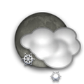
 shower(s) snow small hail/snow pellets Temperature: 1°C / 34°F
Wind: 15km/h West gusting to 26.5km/h
Cloud: Few at 600ft Broken at 2300ft
Satellite map of Rins-See and it's surroudings...
Geographic features & Photographs around Rins-See in Bayern, Germany
populated place a city, town, village, or other agglomeration of buildings where people live and work.
- Entmoos (0km)
- Siferling (1.4km)
- Lampersberg (1.4km)
- Wall (1.4km)
- Holzleiten (1.4km)
- Reipersberg (2.1km)
- Straßkirchen (2.1km)
- Benning (2.1km)
- Hölking (2.1km)
- Irlach (2.1km)
- Aich (2.1km)
- Prutting (2.1km)
- Aschau (2.5km)
- Wilperting (2.5km)
- Hayng (2.5km)
- Straß (2.5km)
- Berg (2.5km)
- Tödtenberg (2.5km)
- Reischach (2.5km)
- Untersee (2.5km)
- Osterlehen (2.5km)
- Haberspoint (2.5km)
- Stucksdorf (2.8km)
- Osterfing (2.8km)
- Straßöd (2.8km)
- Haid (3.5km)
- Söchtenau (3.5km)
- Weikering (3.5km)
- Ullerting (3.5km)
- Lohen (3.5km)
- Schwabering (3.5km)
- Lochen (3.5km)
- Ziellechen (3.5km)
- Hofstätt (3.5km)
farm a tract of land with associated buildings devoted to agriculture.
lake a large inland body of standing water.
- Rins-See (0km)
- Siferlinger See (1.4km)
- Hofstätter See (3.5km)
forest(s) an area dominated by tree vegetation.
- Siferlinger Holz (2.5km)
- Loher Holz (2.5km)
Accommodation around Rins-See
BEST WESTERN Grand City Rosenheim Brixstrasse 3, Rosenheim
TRYP by Wyndham Rosenheim Brixstrasse 3, Rosenheim
Hammerwirt Kufsteinerstr. 29, Rosenheim
airfield a place on land where aircraft land and take off; no facilities provided for the commercial handling of passengers and cargo.
- Vogtareuth (2.1km)
mountain an elevation standing high above the surrounding area with small summit area, steep slopes and local relief of 300m or more.
- Brand Berg (4.2km)
 Wikipedia entries close to Rins-See
- Prutting city m city
- Söchtenau city l city
- Vogtareuth city l city
- Schechen city l city
- Simssee lake waterbody
- Stephanskirchen city j city
- Bad Endorf city j city
- Neukirchen am Simssee city n city
- Schonstett city m city
- Rott am Inn city l city
- Rosenheim city g city
- Großkarolinenfeld city k city
- Riedering city k city
- Griesstätt city l city
- Söllhuben city o city
- Höslwang city m city
Airports close to Rins-See
Munich(MUC), Munich, Germany (65.5km)Salzburg(SZG), Salzburg, Austria (70.5km)
Oberpfaffenhofen(OBF), Oberpfaffenhofen, Germany (80.7km)
Furstenfeldbruck(FEL), Fuerstenfeldbruck, Germany (87.3km)
Innsbruck(INN), Innsbruck, Austria (111.3km)
Airfields or small strips close to Rins-See
Erding, Erding, Germany (55.6km)Eggenfelden, Eggenfelden, Germany (75.2km)
Landsberg lech, Landsberg, Germany (111.8km)
Ingolstadt manching, Ingolstadt, Germany (115.7km)
Lechfeld, Lechfeld, Germany (118.7km)

 Search
 Explore around
Rins-See?
 Wikipedia near Rins-See
 Where to stay near Rins-See

