
 Search
Traveling Luck for Rottersham Bayern, Germany 
 Explore around
Rottersham?
Explore around
Rottersham? Wikipedia near Rottersham
 Where to stay near Rottersham
The timezone in Rottersham is Europe/Berlin
Morning Sunrise at 07:58 and Evening Sunset at 16:21. It's light
Rough GPS position Latitude. 48.4500°, Longitude. 13.3500°
Morning Sunrise at 07:58 and Evening Sunset at 16:21. It's light
Rough GPS position Latitude. 48.4500°, Longitude. 13.3500°
Weather near Rottersham Last report from Linz / Hoersching-Flughafen, 75.4km away
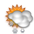 light snow grains freezing fog Temperature: -4°C / 25°F
Wind: 2.3km/h
Cloud: Few at 0ft Broken at 100ft
Satellite map of Rottersham and it's surroudings...
Geographic features & Photographs around Rottersham in Bayern, Germany
populated place a city, town, village, or other agglomeration of buildings where people live and work.
- Rottersham (0km)
- Eholfing (1.4km)
- Wartmanning (2.1km)
- Rottau (2.1km)
- Berging (2.5km)
- Ruhstorf (2.5km)
- Pillham (2.8km)
- Kleeberg (2.8km)
- Hausmanning (2.8km)
- Hötzling (2.8km)
- Neudöbl (3.5km)
- Sulzbach am Inn (3.5km)
- Trostling (3.5km)
- Riedhof (3.5km)
- Rotthof (3.5km)
- Mitterham (4.2km)
- Hader (4.2km)
- Wallham (4.2km)
- Oberindling (4.2km)
- Obersimbach (4.4km)
- Gimplarn (4.4km)
- Dorf (4.4km)
- Parzham (4.4km)
- Fünfeichen (4.4km)
- Engertsham (4.4km)
- Niederindling (4.4km)
- Gstetten (4.4km)
- Sembauer (4.4km)
- Reschau (4.7km)
- Niederhofen (4.7km)
- Höchfelden (4.7km)
- Wollstorf (4.7km)
- Ottenberg (4.7km)
- Unterschwärzenbach (4.7km)
- Afham (4.7km)
- Mittich (4.7km)
farm a tract of land with associated buildings devoted to agriculture.
- Heigerting (0km)
- Liegharting (2.1km)
- Lachham (2.1km)
- Burgdobl (2.1km)
- Hilleröd (2.1km)
- Frimhöring (2.1km)
- Kurzholz (2.5km)
- Euling (2.5km)
- Asenham (2.5km)
- Goder (2.8km)
- Eden (3.5km)
- Krottenberg (3.5km)
- Aiching (3.5km)
- Lindau (3.5km)
- Leopoldsberg (3.5km)
- Hager (4.2km)
- Hub (4.2km)
- Distlzweil (4.4km)
- Bruckhof (4.4km)
- Erben (4.4km)
- Holzham (4.7km)
- Freiung (4.7km)
- Ettal (5.1km)
grazing area an area of grasses and shrubs used for grazing.
- Königswiese (2.5km)
populated locality an area similar to a locality but with a small group of dwellings or other buildings.
- Dobl (4.4km)
 Wikipedia entries close to Rottersham
- Ruhstorf an der Rott city k city
- Schärding city k city
- Neuhaus am Inn city l city
- Tettenweis city m city
- Suben city m city
- Brunnenthal (Oberösterreich) city m city
- Wernstein am Inn city m city
- Neuburg am Inn city l city
- Fürstenzell city j city
- Sankt Marienkirchen bei Schärding city m city
- Bad Griesbach im Rottal city j city
- Reichersberg city m city
- Antiesenhofen city m city
- Kirchham (Landkreis Passau) city m city
- Dreiländerhalle hall landmark
- Schardenberg city m city
Airports close to Rottersham
Horsching international airport (aus - afb)(LNZ), Linz, Austria (75.4km)Salzburg(SZG), Salzburg, Austria (88.2km)
Munich(MUC), Munich, Germany (132.3km)
Furstenfeldbruck(FEL), Fuerstenfeldbruck, Germany (178.4km)
Oberpfaffenhofen(OBF), Oberpfaffenhofen, Germany (180.7km)
Airfields or small strips close to Rottersham
Vilshofen, Vilshofen, Germany (26.9km)Eggenfelden, Eggenfelden, Germany (53.2km)
Wels, Wels, Austria (67.4km)
Linz, Linz, Austria (75.8km)
Straubing, Straubing, Germany (89.9km)