Traveling Luck for Weng Bayern, Germany 
The timezone in Weng is Europe/Berlin
Morning Sunrise at 07:21 and Evening Sunset at 17:30. It's light
Rough GPS position Latitude. 47.9833°, Longitude. 12.1667°
Morning Sunrise at 07:21 and Evening Sunset at 17:30. It's light
Rough GPS position Latitude. 47.9833°, Longitude. 12.1667°
Weather near Weng Last report from Erding, 46.7km away
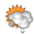
 shower(s) snow small hail/snow pellets Temperature: 1°C / 34°F
Wind: 15km/h West gusting to 26.5km/h
Cloud: Few at 600ft Broken at 2300ft
Satellite map of Weng and it's surroudings
Geographic features & Photographs around Weng in Bayern, Germany
populated place a city, town, village, or other agglomeration of buildings where people live and work.
- Wechselberg (0km)
- Weng (0km)
- Goßmaning (1.4km)
- Haid (1.4km)
- Katzbach (2.1km)
- Untermühle (2.1km)
- Sunkenrot (2.1km)
- Griesstätt (2.5km)
- Zainach (2.5km)
- Berg (2.5km)
- Holzhausen (2.5km)
- Unterwöhrn (2.5km)
- Schmiding (2.8km)
- Kolbing (2.8km)
- Kornau (2.8km)
- Wörlham (2.8km)
- Lengdorf (2.8km)
- Rott am Inn (2.8km)
- Dobl (2.8km)
- Kettenham (3.5km)
- Raming (3.5km)
- Bergham (3.5km)
- Straß (3.5km)
- Leiten (3.5km)
- Unterlohen (3.5km)
- Oberlohen (3.5km)
- Meiling (3.5km)
- Au (3.5km)
- Viehhausen (3.5km)
- Feldkirchen (3.5km)
- Sendling (4.2km)
- Attelthal (4.2km)
- Eglham (4.2km)
- Arbing (4.3km)
- Wurzach (4.3km)
- Ferchen (4.3km)
- Weichselbaum (4.3km)
- Attel (4.5km)
- Ramerberg (4.5km)
- Winkl (4.5km)
- Vogtareuth (4.5km)
- Kobel (4.5km)
farm a tract of land with associated buildings devoted to agriculture.
- Wabach (0km)
- Geiereck (0km)
- Unterkatzbach (2.1km)
- Eßbaum (2.5km)
- Altenhohenau (2.5km)
- Oberkatzbach (2.5km)
- Harring (2.8km)
- Hochholz (3.5km)
- Mauth (3.5km)
- Rottmoos (4.3km)
- Ober Saurain (4.8km)
stream a body of running water moving to a lower level in a channel on land.
forest(s) an area dominated by tree vegetation.
- Altenhohenau (2.5km)
- Laiminger-Holz (3.5km)
- Hoch Holz (3.5km)
 Wikipedia entries close to Weng
- Griesstätt city l city
- Ramerberg city m city
- Vogtareuth city l city
- Rott am Inn city l city
- Elend (Wasserburg) city o city
- Schechen city l city
- Schonstett city m city
- Söchtenau city l city
- Halfing city l city
- Pfaffing (Landkreis Rosenheim) city l city
- Emmering (Landkreis Ebersberg) city m city
- Eiselfing city l city
- Edling city l city
- Prutting city m city
- Wasserburg am Inn city i city
- Frauenneuharting city m city
Airports close to Weng
Munich(MUC), Munich, Germany (56.9km)Salzburg(SZG), Salzburg, Austria (75.4km)
Oberpfaffenhofen(OBF), Oberpfaffenhofen, Germany (76.1km)
Furstenfeldbruck(FEL), Fuerstenfeldbruck, Germany (81.4km)
Innsbruck(INN), Innsbruck, Austria (116km)
Airfields or small strips close to Weng
Erding, Erding, Germany (46.7km)Eggenfelden, Eggenfelden, Germany (70.4km)
Ingolstadt manching, Ingolstadt, Germany (106.9km)
Landsberg lech, Landsberg, Germany (107.8km)
Lechfeld, Lechfeld, Germany (113.7km)

 Search
 Explore around
Weng?
 Wikipedia near Weng
 Where to stay near Weng