
Cultural heritage · Mexico
Camino Real de Tierra Adentro
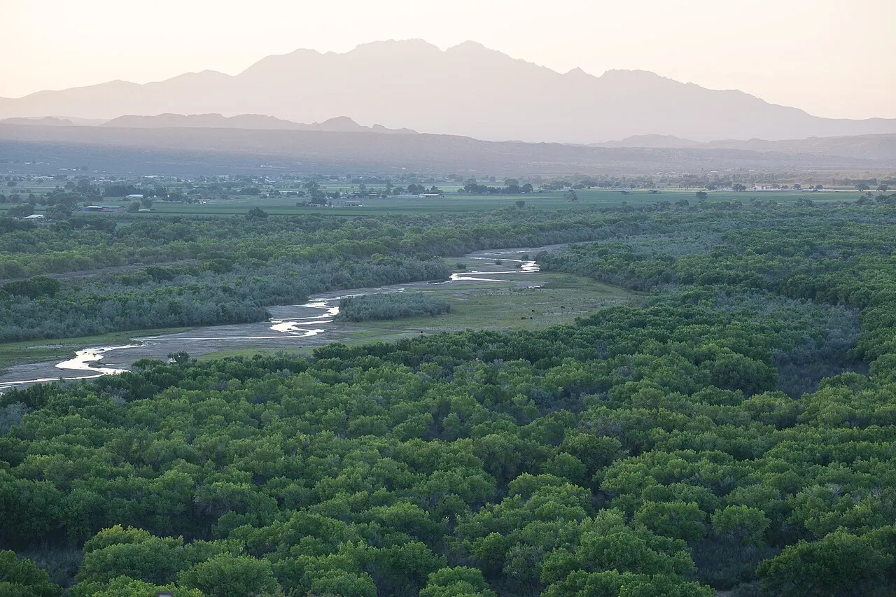
Camino Real de Tierra Adentro was the Royal Inland Road, also known as the Silver Route. The inscribed property consists of 55 sites and five existing World Heritage sites lying along a 1400 km section of this 2600 km route, that extends north from Mexico City to Texas and New Mexico, United States of America. The route was actively used as a trade route for 300 years, from the mid-16th to the 19th centuries, mainly for transporting silver extracted from the mines of Zacatecas, Guanajuato and San Luis Potosí, and mercury imported from Europe. Although it is a route that was motivated and consolidated by the mining industry, it also fostered the creation of social, cultural and religious links in particular between Spanish and Amerindian cultures.
Heritage at a glance
- First inscribed
- 2010
- UNESCO region
- Latin America and the Caribbean
- Selection criteria
- (ii)(iv)
- Property area (hectares)
- 3,101.91
Why this place matters
UNESCO’s assessment of its heritage significance, adapted in formatting from the source dataset.
Brief synthesis
The Camino Real de Tierra Adentro constitutes a part of the Spanish Intercontinental Royal Route from Mexico City to Santa Fe. The property, consists of five existing urban World Heritage sites and 55 other sites related to the use of the road, such as bridges, former haciendas, historic centres/towns, a cemetery, former convents, a mountain range, stretches of road, a mine, chapels/temples and caves within a 1,400 km stretch of the road between Mexico City and the Town of Valle de Allende. The Camino was an extraordinary phenomenon as a communication channel. Silver was the driving force that generated the wealth and commitment of the Spanish Government and the will of colonists to ‘open up’ the northern territory for mining, to establish the necessary towns for workers and to build the forts, haciendas, and churches.
The outcome of this highly profitable process was the development of mines, and the construction of the road and bridges, the establishment of multi-ethnic towns, with elaborate buildings that reflect a fusion of Spanish and local decoration, an agricultural revolution in the countryside centered on large hacienda estates with churches, and the movement of peoples up and down the road, facilitated to a great degree initially by settlements of muleteers, all of which led to the development of a distinctive culture along the route. Ultimately the wealth of silver led to massive economic development in Spain and other parts of Europe and a period of great economic inflation. The impact of the road was enormous in terms of social tensions as well as ultimately social integration between the many people that came to be involved in the economic development. The structures in the property together reflect some aspects of this interchange of ideas and people along the southern stretch of the road.
Criterion (ii):
The Camino Real de Tierra Adentro became one of the most important routes to bond the Spanish Crown with its northern domains in the Americas. Along the southern part of the route is a collection of sites related to work in mines and haciendas, merchant trading, military, evangelism and the administrative structure designed to control the immense territory from the Spanish metropolitan hub, adapted to the local environment, materials and technical practices, that reflect an outstanding interchange of cultural and religious ideas.
Criterion (iv):
An ensemble of sites along the southern part of the Camino Real de Tierra Adentro, including examples of buildings, architectural and technological ensembles, illustrate a significant stage in human history - the Spanish colonial exploitation of silver and the transformation of associated rural and urban landscapes.
Integrity
The component parts of the serial nomination illustrate the variety and diversity of functions and physical components that reflect the impact of the Camino Real de Tierra Adentro. Some of the parts are vulnerable to inadequately controlled development, particularly of new roads, the disturbance of landscape settings, and physical neglect of fabric.
Authenticity
The specific way individual components reflect the overall impact of the road need to be set out more clearly in order that their individual contributions can be better reflected and understood, particularly in the case of existing inscribed World Heritage properties. Management and protection requirements Considerable legal protection is in place at federal, state and local levels. In terms of archaeology, the sites and particularly the road itself are less well protected. The conservation condition of most of the 60 nominated properties is generally good.
Management arrangements exist at federal level, trough the National Institute on Anthropology and History (INAH), and at state level in each of the ten states concerned. The management systems for the majority of the components are adequate and the overview role of the INAH is appropriate. Although there is no overall coordinated formal management framework for all components, the National Conference of Governors has committed to support the project of the Camino Real de Tierra Adentro through the formation of a coordinating work group. There is a need to define and protect the setting of the nominated sites beyond the proposed buffer zones when related to landscape structures; to put in place legal protection for all the individual sites; and to establish an overall coordinated management system that encompasses all the sites.
Places within this listing
This is a serial property with 60 components in the imported record.
View the component places
- Temple of San Pantaleón Mártir in the Town of Noria de San Pantaleón (1351-032)
- Temple of Nuestra Señora de los Ángeles of the town of Noria de Ángeles (1351-028)
- Chapel of the former hacienda of La Inmaculada Concepción de Palmitos de Arriba (1351-047)
- Chapel of San Nicolás Tolentino of the former hacienda of San Nicolás de Quijas (1351-026)
- Former hacienda of San Diego de Navacoyán and Puente del Diablo (Devil’s Bridge) (1351-042)
- Chapel of the former hacienda of La Limpia Concepción de Palmitos de Abajo (Huichapa) (1351-048)
- Historic centre of the city of Guanajuato and its adjacent mines (World Heritage, 1988) (1351-016)
- Stretch of the Camino Real between the bridge of La Colmena and the Former hacienda of La Cañada (1351-006)
- Protective town of San Miguel and Sanctuary of Jesús Nazareno de Atotonilco (World Heritage, 2008) (1351-015)
- Town of Pinos (1351-027)
- Town of Indé (1351-052)
- Town of Aculco (1351-002)
- Mine of Ojuela (1351-057)
- Cave of Ávalos (1351-036)
- Bridge of Atongo (1351-003)
- Bridge La Quemada (1351-014)
- Bridge of Ojuelos (1351-019)
- Bridge of El Fraile (1351-011)
- Bridge of San Rafael (1351-013)
- Sanctuary of Plateros (1351-038)
- Town of Valle de Allende (1351-059)
- Town of San Pedro del Gallo (1351-050)
- Cave of Las Mulas de Molino (1351-058)
- Former hacienda of Peñuelas (1351-022)
- Former hacienda of Cieneguilla (1351-023)
- Cemetery in Encarnación de Díaz (1351-021)
- Former hacienda of Chichimequillas (1351-008)
- Former hacienda of Ciénega de Mata (1351-020)
- Temples in the town of Nombre de Dios (1351-041)
- Historic centre of the city of Durango (1351-043)
- Former hacienda of Pabellón de Hidalgo (1351-025)
- Historic ensemble of the Town of Ojuelos (1351-018)
- Temple of the town of San José de Avino (1351-046)
- Chapel of the former hacienda of Buenavista (1351-009)
- Historic ensemble of the city of Sombrerete (1351-031)
- Architectonic ensemble of the Town of Nazas (1351-049)
- Architectonic ensemble of the Town of Mapimí (1351-051)
- Historic ensemble of the city of Aguascalientes (1351-024)
- Sierra de Órganos (Mountain Range of Órganos) (1351-033)
- Historic centre of the city of San Juan del Río (1351-007)
- Historic centre of the city of San Luis Potosí (1351-039)
- Temple of San Miguel of the town of Villa Ocampo (1351-055)
- Architectonic ensemble of the Town of Chalchihuites (1351-034)
- Former college of San Francisco Javier in Tepotzotlán (1351-001)
- Temples in the town of Cuencamé and Cristo de Mapimí (1351-044)
- Chapel of San Mateo of the Former hacienda of La Zarca (1351-053)
- Historic centre of the city of Lagos de Moreno and bridge (1351-017)
- Chapel of the Refugio of the former hacienda of Cuatillos (1351-045)
- Former hacienda of the Limpia Concepción of El Canutillo (1351-054)
- Historic centre of the city of México (World Heritage, 1987) (1351-00)
- Stretch of the Camino Real between Ojocaliente and Zacatecas (1351-035)
- Chapel of San Antonio of the Former hacienda of Juana Guerra (1351-040)
- Former convent of San Francisco in Tepeji del Río and bridge (1351-005)
- Stretch of the Camino Real between Aculco and San Juan del Río (1351-004)
- Historic centre of the city of Zacatecas (World Heritage, 1993) (1351-037)
- Historic centre of the city of Querétaro (World Heritage, 1996) (1351-010)
- Stretch of the Camino Real between Nazas and San Pedro del Gallo (1351-056)
- Former college of Nuestra Señora de Guadalupe of Propaganda Fide (1351-030)
- Former Royal hospital of San Juan de Dios of San Miguel de Allende (1351-012)
- Temple of Nuestra Señora de los Dolores in Villa González Ortega (1351-029)