
 Search
Traveling Luck for Vik Södermanlands Län, Sweden 
 Explore around
Vik?
Explore around
Vik? Wikipedia near Vik
 Where to stay near Vik
The timezone in Vik is Europe/Stockholm
Morning Sunrise at 07:37 and Evening Sunset at 16:44. It's light
Rough GPS position Latitude. 59.0667°, Longitude. 15.9000°
Morning Sunrise at 07:37 and Evening Sunset at 16:44. It's light
Rough GPS position Latitude. 59.0667°, Longitude. 15.9000°
Weather near Vik Last report from Orebro Private , 56km away
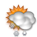 light snow grains Temperature: -1°C / 30°F
Wind: 10.4km/h Northeast
Cloud: Few at 500ft Broken at 1100ft
Satellite map of Vik and it's surroudings
Geographic features & Photographs around Vik in Södermanlands Län, Sweden
populated place a city, town, village, or other agglomeration of buildings where people live and work.
- Vik (0km)
- Båsenberga (1km)
- Logölet (1km)
- Hagsätter (1km)
- Hacksta (2.9km)
- Vretsta (3.1km)
- Viala (3.7km)
- Hagnäset (3.7km)
- Sävesta (4.1km)
- Vingåker (4.5km)
- Boda (5km)
- Kåsta (5.1km)
- Norra Spånga (5.5km)
- Södra Spånga (5.5km)
- Sandstugan (5.7km)
- Fredrikslund (5.7km)
- Skogalund (5.7km)
- Gillbergatorp (5.7km)
- Vannala (5.7km)
- Västtorp (6km)
- Lunda (6.1km)
- Torp (6.3km)
- Kåstaholm (6.4km)
- Berga (6.5km)
- Lindbol (7.2km)
- Vad (7.2km)
- Grövsbol (7.4km)
- Billsbro (7.4km)
- Österåker (7.9km)
- Hälleråd (7.9km)
- Baralund (8km)
- Bromma (8.2km)
- Granholmen (8.2km)
- Tallsäter (8.2km)
farm a tract of land with associated buildings devoted to agriculture.
farms tracts of land with associated buildings devoted to agriculture.
- Kesäter (2.9km)
- Klockarbol (4.5km)
- Vad (5km)
- Brogetorp (5km)
- Skenäs (5.5km)
- Stora Lundbyskog (8.2km)
- Lilla Lundbyskog (8.2km)
stream a body of running water moving to a lower level in a channel on land.
- Vingåkersån (4.1km)
- Gammalån (4.5km)
Accommodation around Vik
HOTEL GILLET Tingshusgatan 10, Katrineholm

Hotell Gillet Tingshusgatan 10, Katrineholm
HOTEL KATRINEBERG SKOLDHEMSVAGEN 3, SKOLDINGE-KATRINEHLM
lake a large inland body of standing water.
- Vadstorpssjön (7.2km)
- Kolsnaren (8.2km)
church a building for public Christian worship.
- Västra Vingåker (2.9km)
second-order administrative division a subdivision of a first-order administrative division.
- Vingåkers Kommun (1km)
hill a rounded elevation of limited extent rising above the surrounding land with local relief of less than 300m.
- Tormosseberg (6.5km)
 Wikipedia entries close to Vik
- Vingåker city l city
- Hjälmaren lake waterbody
- Katrineholm city i city
- Ysätters-Kajsa
- Flodafors
- Arboga city i city
- Schloss Stenhammar manor-house landmark
- Kungsör (Gemeinde) city j city
- Kungsör city j city
- Finspång city i city
- Hassle archaeologic
- Kumla (Gemeinde) city i city
- Skirö isle
- Behrn Arena landmark landmark
- Hallsberg city k city
- Örebro city e city
Airports close to Vik
Orebro(ORB), Orebro, Sweden (56km)Kungsangen(NRK), Norrkoeping, Sweden (61.3km)
Skavsta(NYO), Stockholm, Sweden (70.7km)
Vasteras(VST), Vasteras, Sweden (76.6km)
Saab(LPI), Linkoeping, Sweden (80km)
Airfields or small strips close to Vik
Arboga, Arboga, Sweden (38.1km)Bjorkvik, Bjorkvik, Sweden (52.9km)
Bravalla, Norrkoeping, Sweden (55.8km)
Eskilstuna, Eskilstuna, Sweden (59.9km)
Strangnas, Strangnas, Sweden (79.6km)