Traveling Luck for U.S. Virgin Islands. U.S. Virgin Islands, North America
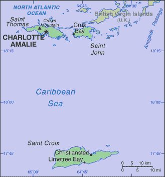
Virgin Islands is located in Caribbean, islands between the Caribbean Sea and the North Atlantic Ocean, east of Puerto Rico.
Land in Virgin Islands is mostly hilly to rugged and mountainous with little level land.
Virgin Islander land covers an area of 1910 square kilometers which is twice the size of Washington, DC
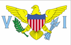
 Virgin Islander national flag (Flag of U.S. Virgin Islands)
As for the Virgin Islander climate; subtropical, tempered by easterly trade winds, relatively low humidity, little seasonal temperature variation; rainy season September to November.
Virgin Islander(s) (US citizens) speak English 74.7%, Spanish or Spanish Creole 16.8%, French or French Creole 6.6%, other 1.9% (2000 census).
 Virgin Islander map
Regions of U.S. Virgin Islands
During the 17th century, the archipelago was divided into two territorial units, one English and the other Danish. Sugarcane, produced by slave labor, drove the islands' economy during the 18th and early 19th centuries. In 1917, the US purchased the Danish portion, which had been in economic decline since the abolition of slavery in 1848.
Tourism is the primary economic activity, accounting for 80% of GDP and employment. The islands normally host 2 million visitors a year. The manufacturing sector consists of petroleum refining, textiles, electronics, pharmaceuticals, and watch assembly. The agricultural sector is small, with most food being imported. International business and financial services are small but growing components of the economy. One of the world's largest petroleum refineries is at Saint Croix. The islands are subject to substantial damage from storms. The government is working to improve fiscal discipline, to support construction projects in the private sector, to expand tourist facilities, to reduce crime, and to protect the environment.
Virgin Islander natural resources include sun, sand, sea, surf
important location along the Anegada Passage - a key shipping lane for the Panama Canal; Saint Thomas has one of the best natural deepwater harbors in the Caribbean
Virgin Islander religion is Baptist 42%, Roman Catholic 34%, Episcopalian 17%, other 7%.
Natural hazards in Virgin Islands include several hurricanes in recent years; frequent and severe droughts and floods; occasional earthquakes.

 Search