
 Search
Traveling Luck for Christmas Island. Christmas Island, Asia
Christmas Island is located in Southeastern Asia, island in the Indian Ocean, south of Indonesia.
Land in Christmas Island is steep cliffs along coast rise abruptly to central plateau.
Christmas Island land covers an area of 135 square kilometers which is about three-quarters the size of Washington, DC
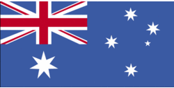 Christmas Island national flag (Flag of Christmas Island)
As for the Christmas Island climate; tropical with a wet and dry season; heat and humidity moderated by trade winds; wet season (December to April).
Christmas Islander(s) speak English (official), Chinese, Malay.
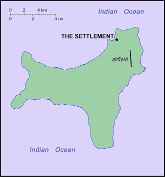 Christmas Island map
Regions of Christmas Island
Named in 1643 for the day of its discovery, the island was annexed and settlement began by the UK in 1888. Phosphate mining began in the 1890s. The UK transferred sovereignty to Australia in 1958. Almost two-thirds of the island has been declared a national park.
Phosphate mining had been the only significant economic activity, but in December 1987 the Australian Government closed the mine. In 1991, the mine was reopened. With the support of the government, a $34 million casino opened in 1993. The casino closed in 1998. The Australian Government in 2001 agreed to support the creation of a commercial space-launching site on the island, projected to begin operations in the near future.
Christmas Island natural resources include phosphate, beaches
located along major sea lanes of Indian Ocean
Christmas Island religion is Buddhist 36%, Muslim 25%, Christian 18%, other 21% (1997).
Natural hazards in Christmas Island include the narrow fringing reef surrounding the island can be a maritime hazard.